

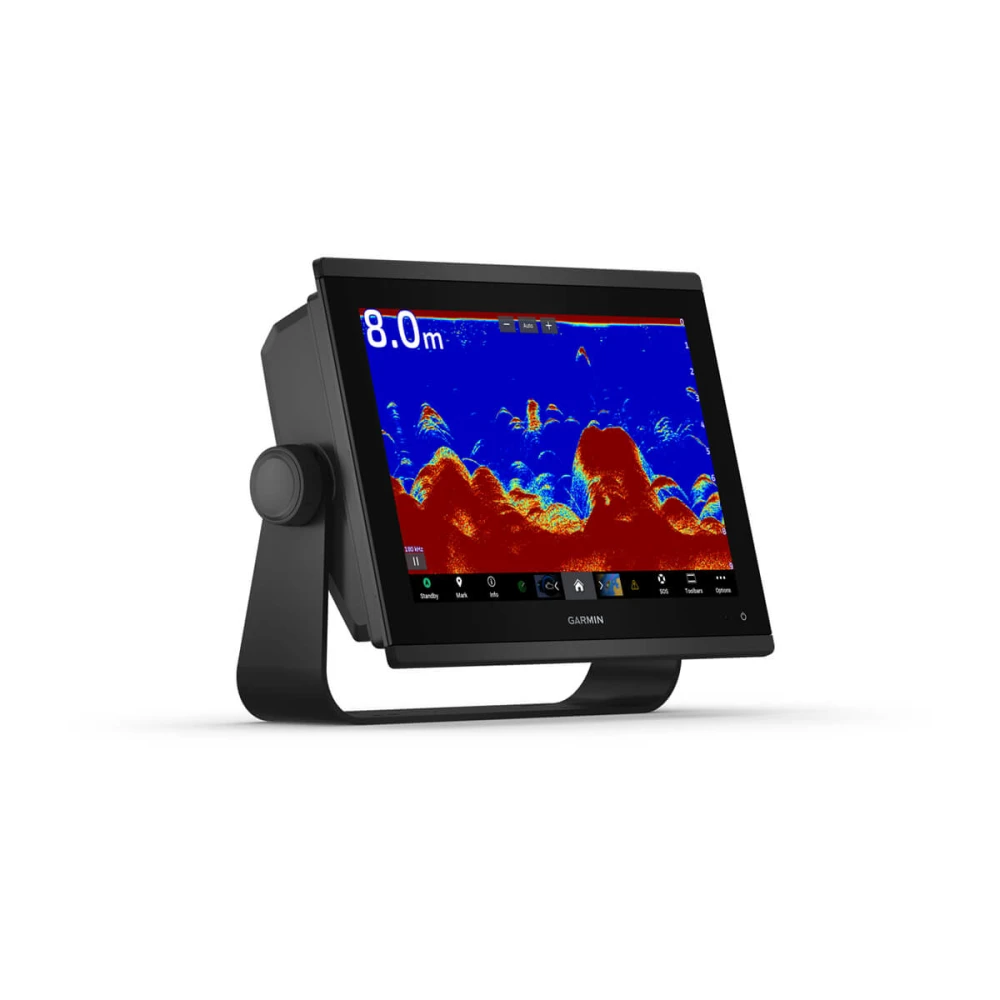
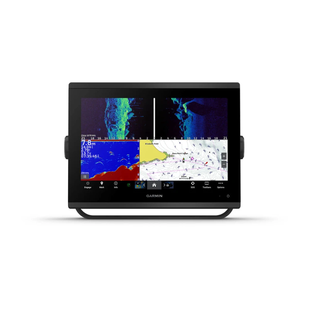
Faster, sharper, smarter!
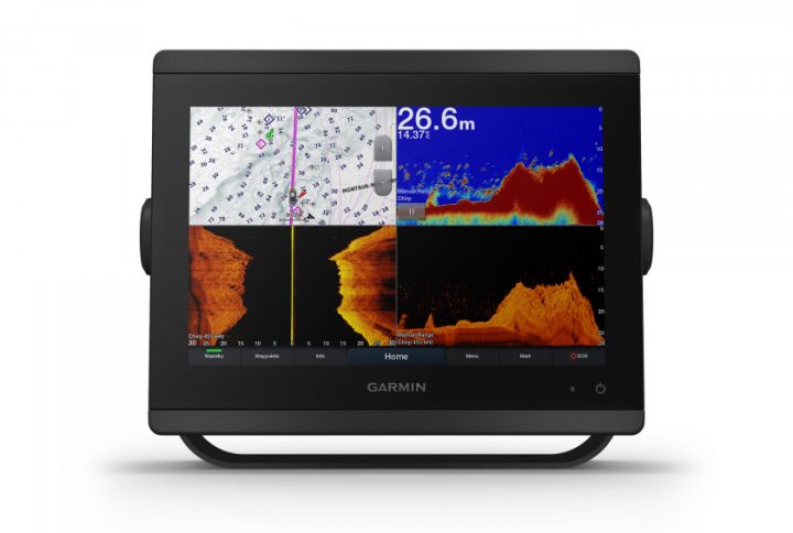
The new GPSMAP series features significantly higher resolution and even faster processor performance. Garmin's 12" touchscreen offers optimized map viewing, an excellent user interface, and is easily integrated into your Garmin marine system. Additionally, the bright display provides excellent readability in direct sunlight. It includes CHIRP, ClearVü, and SideVü sonar.
Garmin Sailassist – navigation function
View laylines, race start line directions, an enhanced wind rose, courses and COG, true wind data fields and tide slider, currents and time, wind angle, drift, current, wind speed and much more.
Optional Bluchart nautical chart
Bluechart g3 and Bluechart g3 Vision charts offer the best of Garmin data, Navionics, Auto Guidance technology and other advanced navigation features.
Garmin Marine Network
If you have multiple Garmin devices on your boat, information such as maps, user data, radar and IP cameras can be easily shared between them.
NMEA2000 and NMEA0183 compatibility
Connect your chartplotter directly to autopilot, digital switching, weather data, FUSION-Link audio system, media, VHF, AIS and more.
Integrated fish finder functions
Powerful sonar capabilities at your fingertips—all you need to do is add transducers. The device features a built-in 1kW CHIRP sonar, CHIRP ClearVü and SideVü sonar. It also supports Panoptix sonar for a comprehensive view, premium Garmin sonar modules, and a wide range of transducers (sold separately). Networked combo devices can exchange data from their internal sonar with other devices on the network. You can also choose which information to overlay on the sonar screen, such as radar, time, or GPS speed.
ActiveCaptain App
Connect your device to Wi-Fi and connect it to the free ActiveCaptain mobile app. You'll have access to OneChart, smart notifications, software updates, Garmin Helm, the Garmin Quickdraw community, and more.
Integrated ANT technology
Connect your devices, like quatix marine watches, gWind Wireless 2 transducers, GNX Wind marine instruments and radios with GPSMAP Plus.
JI939 Connectivity
It is easy to integrate data from various engines (including Yamaha engines).
ONEHELM function
This feature displays all options from third-party vendors on one page, such as EmpireBus Digital Switching.
PANOPTIX Support
Connect your chartplotter to easy-to-evaluate PANOPTIX or PANOPTIX LIVESCOPE fishfinders (transducers available separately) for a real-time 360° view below and beside your boat.
Technical specifications
General
| Dimensions | 308 x 228 x 82 mm |
| Display dimensions, W x H | Diagonal 12.1" (262 x 163 mm) |
| Display resolution, W x H | 1280 x 800 pixel |
| Display type | WSVGA display |
| Weight | 3.0 kg |
| Waterproof | IPX7 |
| Polarized support | Yes |
| JI939 | Yes |
| Energy consumption | Max. Power Consumption at 10V DC: 26.5W. Typical power consumption at 12VDC: 1.7A. Max. Current Draw at 12V DC: 2.2A |
| Antenna | Internal or external via NMEA2000 |
| Mounting options | Mounting with bracket or flush-mounted |
| Receiver | Highly sensitive with 10 Hz |
| Garmin Marine Network Connections | 2 |
Cards and memory
| Pre-installed map | World Base Map |
| Data card support | 2 microSD memory cards; maximum 32 GB |
| Waypoint | 5,000 waypoints |
| Routes | 100 routes |
| Track log | 50,000 points, 50 saved tracks |


Reviews
There are no reviews yet.